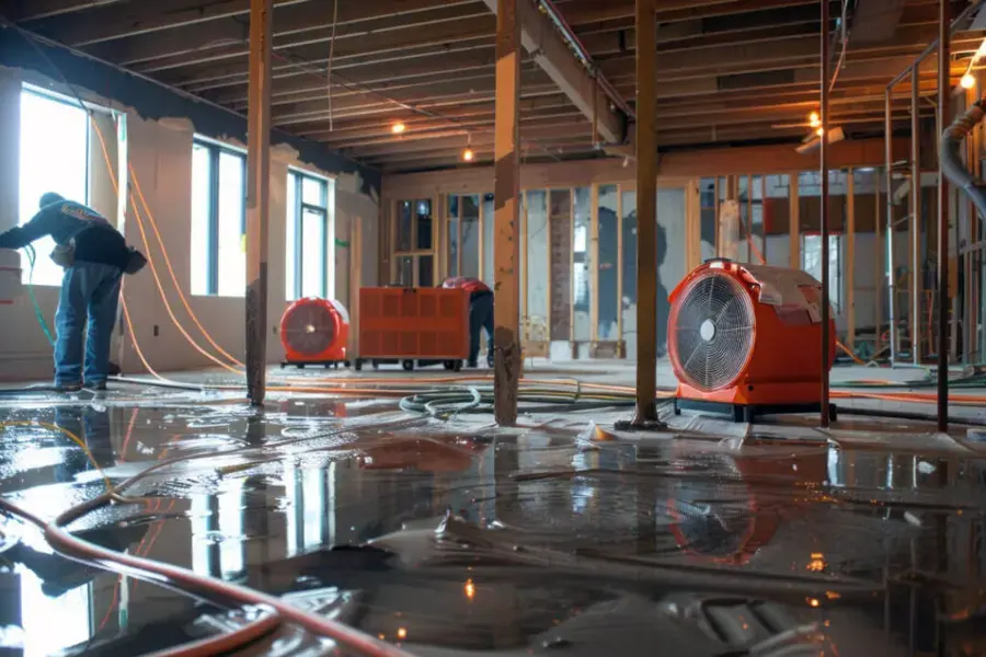
Savage sits on the south bank of the Minnesota River, and the river has a long record of rising into the spring and early summer. Most crests stay on the road and the bottomlands, but a few reach the point where water finds a foundation.
Key takeaways
- Savage road impacts around Highways 13 and 101 and Zinran Avenue begin when the Minnesota River reaches 710 to 712 feet above sea level.
- The highest crest on record in Savage was 719 feet on April 15, 1965, and the second highest was near 717 feet on June 30, 2024.
- Water that comes in from a river is treated as contaminated, so soft materials that soaked in it are usually removed, not dried.
- Standing water goes first, then wet materials are opened and dried until readings match a dry reference.
- Photograph the waterline and keep a log of what was removed before any of it leaves the house.
How river height turns into a wet lower level
A river crest is a number on a gauge, and for most Savage homes that number only matters when it climbs high enough to reach streets, ponds and low ground. The water then looks for the easiest way into a home: a window well, a floor drain, a cracked slab joint or the pit for a sump pump.
The Minnesota River forms the northern boundary of Savage, and the Credit River and Eagle Creek both run to it through the city. When the river is high, those streams cannot drain freely, and runoff backs up behind them.
That is why a home that never sees a flood warning can still get water in a lower level during a long, wet spring.
- High river levels slow the drainage of storm sewers and creeks that empty into the river.
- Saturated ground pushes water against a foundation from the outside.
- A sump pump that runs without rest can fall behind, or stop if the power fails.
The Savage crest record, year by year
Savage has measured the Minnesota River for a long time, and the record shows how different two high water years can feel.
- April 15, 1965: the river crested at 719 feet, the highest on record, and nearly 300 volunteers built a sandbag dike down the middle of Highway 13.
- 1997: a crest of 715.2 feet.
- April 2001: a crest of about 714 feet.
- March 2019: the river at the Port Cargill gauge reached 711.3 feet, and sandbags were placed on sanitary sewers.
- June 30, 2024: a crest near 717 feet, the second highest on record, with only a few minor road closures.
What the 2024 crest showed
A crest near 717 feet sounds close to the 1965 record, yet the 2024 event brought only a few minor road closures.
Stormwater ponds and controls north and south of Highway 13 keep river water from reaching downtown Savage, and the highway itself was raised after 1965.
What the 2019 sandbags on sewers meant
A 711.3 foot reading is below the high marks of other years, yet sandbags still went on sanitary sewers.
River water can enter a sewer system through low openings, and that can push sewage toward floor drains in the lowest part of a home.
Where the water reaches the road first
City flood notes tie river height to specific places. Impacts around Highways 13 and 101 and Zinran Avenue begin at 710 to 712 feet above sea level.
At 715 feet, the eastbound lanes of Highway 101 near Highway 13 go under water. A resident planning a trip or a business owner watching deliveries can use those numbers as a simple signal.
- Watch the National Weather Service river forecast for the Savage gauge in spring and early summer.
- Treat 710 feet and above as the point to move valuables off lower level floors.
- Treat 715 feet and above as the point to expect road closures and delays.
What river water does inside a home
River water carries soil, runoff and whatever else it crossed on the way. For that reason it is handled as contaminated water, the same family of loss as a sewage backup.
Hard surfaces such as concrete and sealed tile can be cleaned and treated. Porous materials that soaked up the water usually cannot be saved.
- Carpet and carpet pad that sat in river water are removed.
- Drywall that wicked water above the floor is cut back, often above the waterline.
- Insulation in wall cavities that took on water is replaced.
- Boxes, upholstered furniture and rugs that touched the water are usually not salvageable.
The first day with water in a lower level
The first steps are about safety, then about speed. Water that reaches outlets, a furnace or a water heater is an electrical hazard, so the power to that area is shut off before anyone walks in.
After that, the goal is to get standing water out and start documenting.
- Shut off power to the flooded area at the panel only if the panel is dry and reachable.
- Do not walk through standing water that could be near live outlets or cords.
- Photograph the waterline on the walls and the items affected before moving anything.
- Keep a written list of what was damaged, with rough ages and values.
- Call a Savage storm flood cleanup team to start extraction and set up drying.
How extraction and drying work
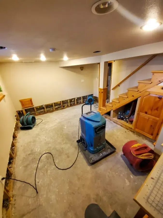
Truck mounted or portable pumps pull the bulk of the water, and small extractors lift what is left in carpet and low spots. Once the standing water is out, the team measures moisture in drywall, framing and concrete to see what is wet and how far it reaches.
From there, wet porous material comes out and the remaining structure is dried with air movers and dehumidifiers. Readings are taken daily, and equipment stays until framing, subfloor and concrete read close to a dry reference.
A lower level handled this way is covered in more detail on the Savage page for basement flooding cleanup.
Drying a basement is slower than most people expect, because concrete holds water and releases it gradually. Pulling equipment early risks leaving moisture behind walls, which is the reason daily readings matter.
- Extraction removes standing water first, then wet carpet and pad.
- Moisture mapping marks the wet and dry areas on walls and floors.
- Air movers and dehumidifiers run until readings reach the drying goal.
- The team leaves a written record of readings for the insurance claim.
Insurance and planning ahead
Many standard homeowner policies treat flood water differently from other water losses, and flood cover is often a separate policy, such as one through the National Flood Insurance Program. Reading the policy before the next high water spring is easier than doing it during a loss.
Savage is also updating the Credit River flood maps from Quentin Avenue to Highway 13 with newer elevation data, so the picture for homes near the creek may change.
For a wider view of how the restoration team handles spring and river losses, see the Burnsville storm and snowmelt flood cleanup page, or browse the Savage water damage pages.
Questions
At what river height do Savage roads begin to flood?
City notes say impacts around Highways 13 and 101 and Zinran Avenue begin at 710 to 712 feet above sea level. At 715 feet, the eastbound lanes of Highway 101 near Highway 13 go under water.
What was the highest Minnesota River crest in Savage?
The highest crest on record was 719 feet on April 15, 1965. The second highest was near 717 feet on June 30, 2024.
Can carpet that got wet from river water be dried and kept?
Usually not. Because river water is contaminated, carpet and pad that soaked in it are removed, and the floor underneath is cleaned and dried.
Does homeowners insurance cover river flooding?
Many standard policies exclude flood water, and cover is often a separate policy. Check the policy wording or ask the insurer before a loss.
How long does a flooded basement take to dry?
It depends on how much water came in and how long it sat. Concrete and framing release moisture slowly, so the team keeps equipment running until daily readings reach the drying goal.